Day 20: Mapping in sunny weather
The sunny weather seems to be here to stay. We are continuing to map the area. The CTD (conductivity, temperature, and depth) and XBT (see earlier report) measurements indicate a shallow sill in the inner part of the fjord.
Unfortunately, this area is covered by icebergs and ice floes and Oden cannot reach so far into the fjord. The existence of a sill is of crucial importance for the stability of the ice, floating on the fjord. We are continuing chasing the sill by dipping a sonar from one of the helicopters. We have yet not observed the sill. Yes almost forgot, KTH was involved in the assemblage of the sonar by borrowing parts and pieces from other systems.
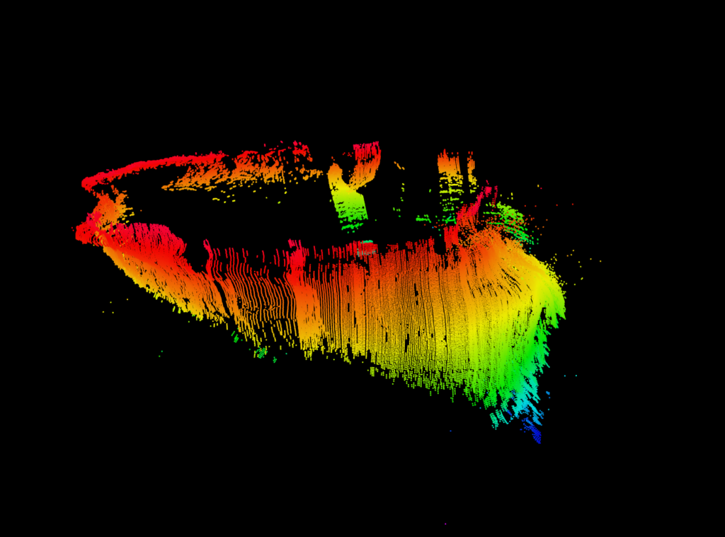
The KTH and University of New Hampshire teams were out measuring two icebergs near Stephenson Island. The aim was to map out the underwater topography employing two different multibeam sonars mounted on two autonomous vehicles. Both teams were successful and a preliminary picture of the submerged part of the iceberg is shown in the picture as well as the KTH-vehicle that performed the measurement. Folks, that’s all for the time being.